
This year I returned to Everest Region. Agenda => to go all the way to Kalapatthar, at an altitude of almost 18.3k feet testing my spirit as well as my newly acquired Sony Alpha 99 full frame with several kilos of solid glass Carl Zeis's.
Below are some of the shots I took along the way - hope you enjoy it. (Click on any pics for a larger view).

I believe this is right after Lukla as you trek down - these houses (or monasteries rather..) caught my attention. I don't have a super zoom lens. This is my fixed 135 mm lens. Was a bit misty for a crisp shot but came out ok.

On this EBC trail - I am sure you will remember this juncture - somewhere before reaching Phakding. DRO does give you all the details but pictures look like paintings. These "oh mani" stone carvings are all along this Sherpa Heartland.

Mt. Thamasherku. This peak looks different from every angle. A sacred mountain at that I believe - Add a little polarizer and sky looks ink blue.

I wanted to give a sense of the trails against the landscape. These trails own you for two weeks. This is still before reaching Phakding.

Another shot of Thamasherku. This mountain is visible all along the way to base camp.

Shot of Dudh Koshi at Phakding as we waited for Dal Bhaat at the lodge. This was taken pretty late at dusk with high ISO and extended exposure. I could have pimped up this shot with a better set up - I was just playing with the settings. Plus I was not in great vantage point. Noise is not that bad even with high ISO. The water is for just to look at. Icy Cold!!

Another DRO laden pic. Looks more like a water color painting than a normal shot. But without it all you capture is white water against the sun. This is right after Phakding. You often see people with their expensive and fancy water filters (oh please!!) fill up their water here.

You know what - I forgot the name of this peak! This is seen from Namche. Another sacred peak I believe. Evening shot with DRO - here however, you get the dark foreground somewhat decent. This was with my 135mm f1.8 lens that weighs a ton.

This is the view of Everest in Shayngboche as you approach Everest View Hotel - which you can see it behind the trees. I have no clue where the pink hue came from on this photo. I could have used some color balance in PS but oh well - may be the sky was pinkish - who knows ....This pic. was from previous trip btw - this year thanks to leftover clouds from recent south Indian Ocean typhoon - it was all cloudy.

Shayngboche hike from Namche (even without the backpack - an activity lot of people do on their acclimatization day) is rather a grueling one - if you ask me. But this is what you are rewarded with. A front row seat of Everest and Ama Dablam (on the left - see photo below) while shipping on them ginger tea and coconut crackers sitting by the hotel patio makes it all worthwhile. Again - this pic. was from previous trip - not this year.

There it is!! Ama Dablam - my favorite mountain of all - in all its glory. Notice the four layers of rock starting from right on this pic. Copper red to dark brown to grey and all white. This pic. also was from previous trip - taken with Alpha 900 - a remarkable camera that I no longer own.

From Everest View Hotel we headed on down to village of Khumjung. Less touristy than Namche and only 600 feet additional in altitude, Khunjung is laid back Sherpa village. I like this place.

Looking towards Northeast from my lodge - this is what you get to see. Ama Dablam!!! Another DRO pumped in shot - looks more animated than I would have liked but I wanted to capture them lodges in the foreground.

Name of the game here is either "Yak" or "Human Back". Hillary School on the background.

Another shot of Ama Dablam from Khumjung. You will see plenty of picture of this mountain down below ...

Yaks returning from EBC on their way to Lukla. They are the life blood of these terrains. Edmund Hillary School in the backdrop.

Another zoomed in shot of Thamasherku ?? I believe, on our way down from Khumjung.

This peak is called Kangtega - Next to Thamasherku - visible from Namche/Shayngboche. Notice the thick layer of ice on top. That alone looks several hundred feet high. This peak is about 22kft.

Village of Khumjung as we were departing.

Leaving village of Khumjung

Heading down to Tengboche - leaving Khumjung behind - Thamasherku, Kangtega and Ama Dablam visible ahead of us.

Tengboche!!! Little cloudy but none-the-less always spectacular. Everest is still visible - can you tell me which one? Had a fresh coffee and carrot cake at the bakery (green roof) at this altitude - can you imagine?? They were excellent. The lodge lady still remembered me on my way back 12 days later.

Tengbohce Monastery - This is all new after fire destroyed the old one several years - they still managed to make it look aged. It was peaceful and spectacular. Shots inside the monastery are not allowed I don't think. Even if they did - I would not shoot it.

Heading to Deboche. Looking back towards the direction of Namche and Tengboche. You can see the monastery on the ridge in the middle of this pciture.

On this trek you cross the Dudh Koshi river about 100 times it seems. This corssing is past Deboche - towards Pangboche. Ama Dablam looms over high above.

Another shot of Dudh Koshi with Ama Dbalam. Too bright of an image for any adjustment for my expertise.

On our way to Pangboche - Tengboche and mountains near Namche in backdrop. Namche is way far back now and even Tengboche monastery is barely visible.
Leaving Pangboche and heading towards Somare - again looked back to the trail towards Pangboce to take this shot. Almost parallel to Ama Dablam base camp now - can you imagine? The house on the ridge on the left is on the trail to Ama Dablam base camp.

Town of Dingboche - Left Ama Dablam behind - as you can see it on the top middle left. Room at the right of the pic is where I spent the night. I ran into 30 doctors from around the world - mostly specializing in high altitude sickness. Boy - did I enjoy talking to some of them?

This is Ama Dablam folks - you rarely see the photo of this peak from this angle. Shot from Dingboche at Alt of almost 15K ft.

Another close up of Ama Dablam from Dignboche.

Left Dignboche for Pheriche. You come across this ridge, from where you can get a 360 Deg view of nothing but mountains. On a bright sunny day this place is magical, spectacular, breathtaking - not enough words to describe it. Another shot of Ama Dablam

Same place but this one with wide angle lens.

Same mountain ridge between Dingboche and Pheriche. You can see the village of Pheriche down below. Next day we will be hiking along the valley and make a dog leg left following this glacier. You can see Lobuche Peak on the center right.

Yet another shot of Ama Dablam - it seems so near yet require 25 days to climb it. Had made few friends down in Phakding - these were previous Everest summiters from Indonesia who were attempting this peak this year. Later I learned that they had to forgo their attempt due to too much snow. They could not get camp two established I heard.

Trekking through the valley towards Lobuche. You can see Lohtse peak on the upper left. But Everest is hidden from this view.

This was one of my favorite shots of the entire trip. Man's creation (stone hut on the right) and mountain all blend in so well to the landscape. One hour out of Pheriche and heading towards Lobuche.

Looking back at Pheriche - barely visible on the center. Ama Dablam looms high up above.

Made a dog leg left and climbing towards Lobuce - we are in the zone now so to speak - surrounded with nothing but mountains and hardly any vegetation - close to 16kft

Another shot of mountains - Melting of glacial ice and a birth of a river (Dudh Koshi). Left Phriche way down below behind the mountains.

Another irresistible shot. Nothing but worlds tallest mountains. Two days from EBC now.

Panaromic shot with my friend Gary, who accompanied me on this trek. He seems busy checking if there is a phone signal!!

Village of Doghla appears out of nowhere all of a sudden. Some people split their Pheriche to Lobuche trek here. Only few lodges though. You can seem'em all in this view.

Captured trekkers heading down to Pheriche - oh what a view!!! Ama Dablam, Thamasherku....any many more I don't even know.

One more shot of Ama Dabalm range before reaching Doghla Pass and near Lobuche Base Camp.

Past Doghla Pass - Lobuche another hoour away. Lobuche base camp visible on center left.

Nuptse face - I captured it just before the sunset.

Next morning - while trekking towards Gorakshep. Same Nuptse face from evening earlier.

Looked back and saw the village of Lobuche that we just left behind.

Lots of snow this year - record snow fall for October breaking 44 year record per one of the US doctors down in Himalayan Rescue Clinic. Lots of Sherpas and Porter were snow blinded for few days I heard. UV is very strong here - better taker kick ass sunglasses - I saw some folks wearing fashion sun glasses (oh please!!).

Pumori up ahead. An intermediate peak in this region but very famous none the less. Lots of fatalities over the years on this mountain.

Pumori and Nuptse. Two hours to Gorakshep.

Another shot of Nuptse and other mountains

Trekkers, Trail and Tall Pumori.

Looking back towards Dingboche and Ama Dabalm range.

Another panoramic shot of Pumori along with trekkers and the trail.

Almost to Gorakshep now. Section from Lobuche to Gorkashep is as remote and treacherous as they come specially when you have lots of snow on the trail. Only rocks, snow and skies - but the view is spectacular everywhere you look. You are surrounded by mountains on all sides. Amazing landscape.

This is looking south east. All these shots against sun - but it is so damn bright.

More shots of of the trail, snow and mountains before reaching Gorakshep.You see Lochtse and Nuptse with Everest just hidden between the two.

Pumori peaking though the rocks. Sundare Sherpa, the legendary climber from Nepal once climb this peak in 8 hours alone and without any oxygen.

This what I came here for. The iconic view of Everst, Lohtse and Nuptse. I am climbing to Kalapatthar Peak. At about 17.5 Kft. Another 1000 feet or so to go still.

And the money shot!!! Top of Kalapatthar at about 18.5Kft. Base camp is right behind the dark ridge on the lower left some 1000 feet below - that I would vist next morning on frigid -15 Deg C. Temp here was about -5 Deg C and time about 3 pm. We are looking towards north east direction here. Lots of people get here in the morning. But sun comes from behind the mountain not allowing a good shot. (Never liked the name "Kalapattahr" btw - It's an Indian Word which means "Black Rock" - probably named after seeing giant black rocks one has to tackle through on the mid-section of this 1500 feet climb from Gorakshep. Rumor has it that an Indian was the first ever to set a foot on this peak hence his given name of "Kalapatthar" stuck)

A Panoramic shot of the Everest Range. This picture is massive 30 MB. Juts click on the pic for a larger view. I could not have timed it better in terms of not having a single piece of cloud on the entire range.

Left of the Everest range looking towards South East. Makalu, Amadablam, Thamasherku - all are there!! Clouds started to roll in.

Few days later back at Tengboce. Another DRO pumped in shot to bring out the details.

Mountain you see from Lukla Airport- not sure the name of it.

Another Peak you see from Lukla Airport. Sky was so damn blue I wish I had not used my polarizer.

This is somewhere on the trail as I was finishing the trek. Like I said - it's either "Yak" or "Human Back" that is the lifeline in this region. Many gates like these - with "Ohm Mani" prayer wheels.

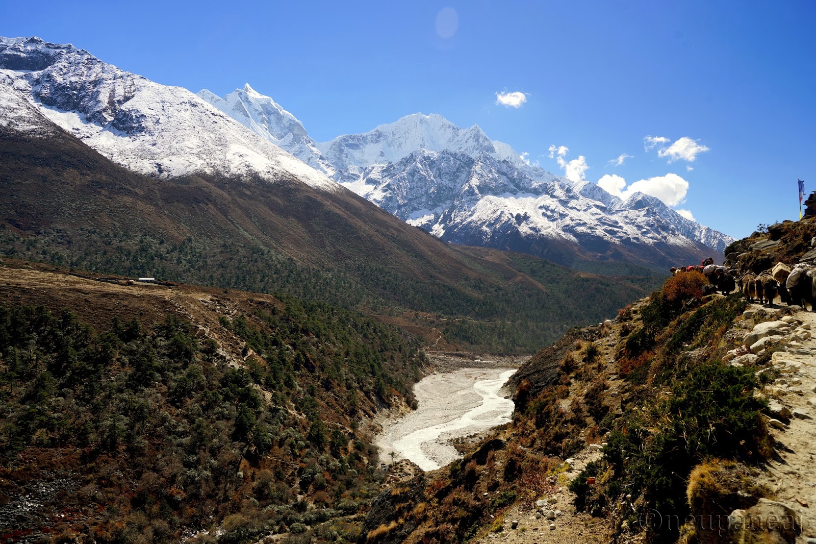
I took this with my iPhone - below Namche on the way to Monjo/Jorsale. You know - on many on line forums, people talk about these trails being crowded and all. Well - here's my answer to that - for the most part this is how crowded it gets and this is what's in store as far view goes. I think it captures both of that essence well.

And that's me - an average everyday trekker on these beyond average landscapes of Everest Region. Thanks for taking time to visit my page. Hope we will cross paths on these trails someday!!!
Happy to see your blog :-)
ReplyDelete